Cathedral Rock


Return To Home Page
  

View to the East from High on the Hog Trail

View To The East High on the Hog Trail
 

Trail Map - Large
Click on Trail Map to Enlarge

View to the North - Hog Heaven Trail
View To The North
Hog Heaven Trail

View to the Northeast High on the Hog Trail
View To The North East - High on the Hog Trail
 
Click on The Pictures to Enlarge


Chicken Point Loop (Hog Wash & Heaven Trails and Much More) - 4.2 Miles
 

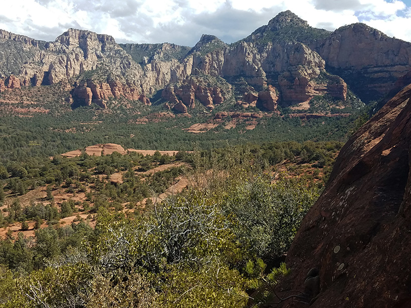
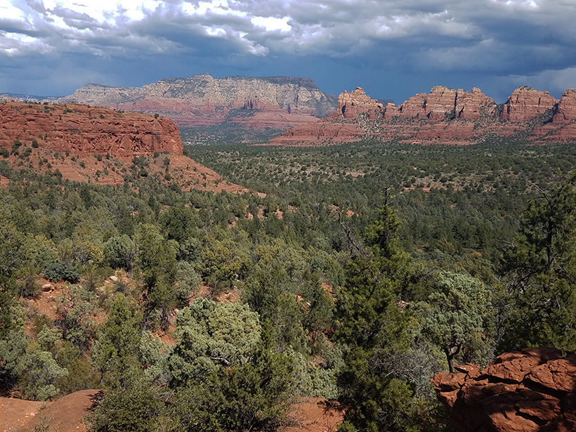
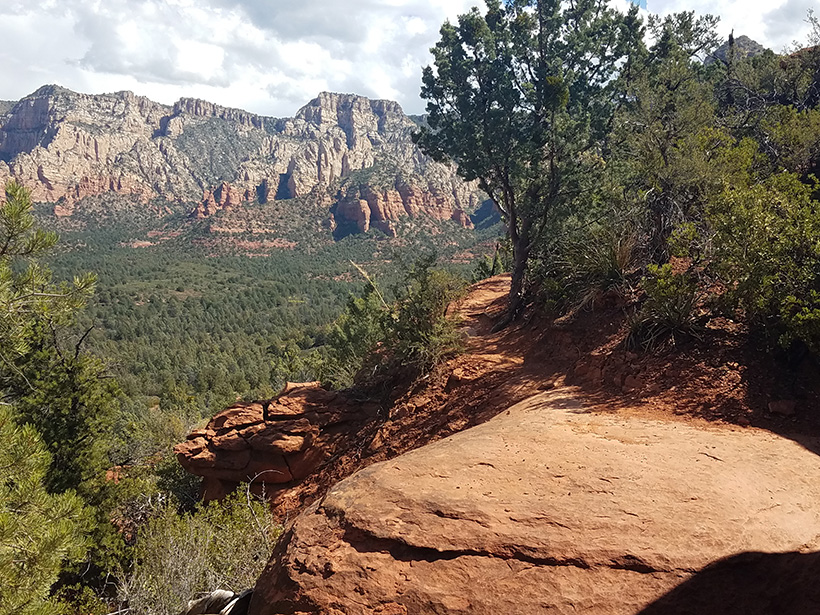
This hiking loop is new and represents one of the best hikes in the Sedona area.  The rock formations which are traversed and the views from Chicken Point, Hog Heaven and High on the Hog Trails are spetacular. These trails are moderate to strenous with numerous rock steps and one area requiring arms for stability. The hike is 4.2 miles with an overall elevation change of 400 feet.

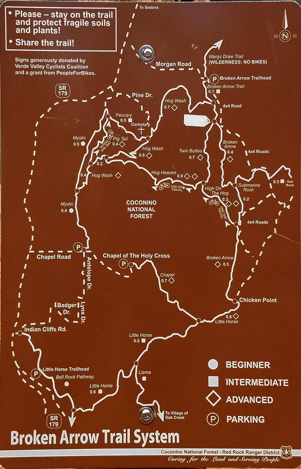
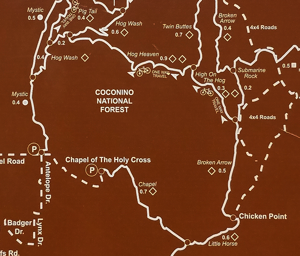
Trail Parking is best at the Mystic Trail Head. However, there are only around 14 spaces. Otherwise one has to use the Broken Arrow Parking Lot.   Broken Arrow Trail can be taken to the Twin Buttes Trail which will lead to the junction of the Hog Heaven Trail and High on the Hog Trail. 

Trail Map - Cropped
   

Below are pictures (left to right) of Chicken Point, hiking down Hog Heaven Trail and of High on the Hog Trail.

View of Chicken Point from the end of Broken Arrow Trail.

   Chicken Point

View to the East on High on the Hog Trail.

   
High on the Hog Trial

View to the East while hiking down from the top of Hog Heaven Trail.  

   
Hog Heaven Trail


Links to the trail sections which form the Chicken Point, Chapel and Hog Trails Loop:


Return to Home Page