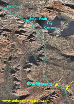
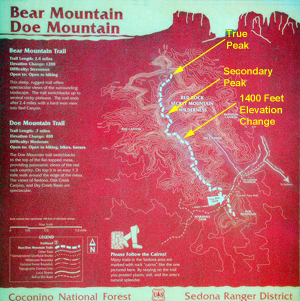
The end of Bear Mountain Trail is shown above. The two asterisks are at trail end (Trail Peak) and on a small rise before
the final Trail Peak. The change in elevation to the small peak is 1400 feet. Fay Canyon is to the east of
the small peak (right). As the hike continues, the hiker climbs
another 600 feet with Fay Canyon to the east (right) (the change in elevation is approximately 2000 feet). The two yellow
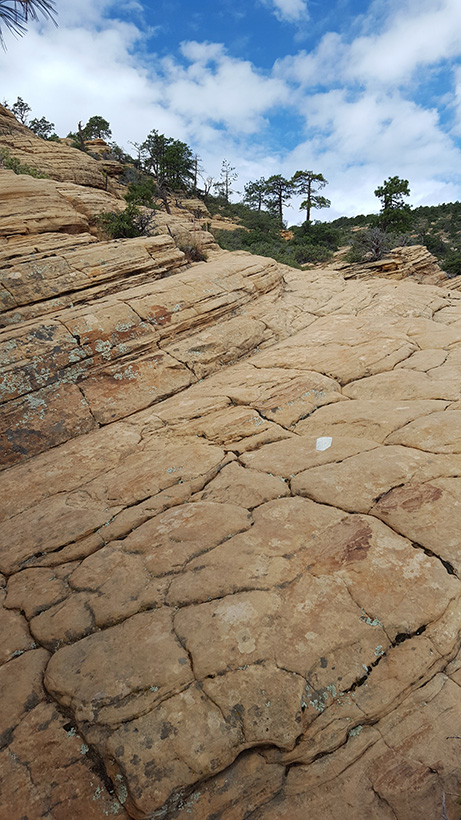
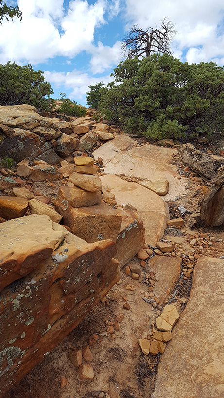
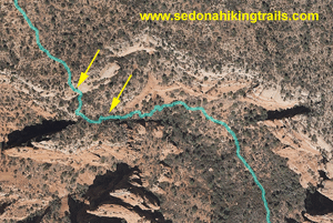
arrows designate the two portions of the trail which have the final two stone steps
which need to be traversed.
To see an aerial photograph from the trail peak of
Bear Mountain to the true peak. The trail now ends below the secondary peak. --Click Here
Click on The Pictures to
Enlarge
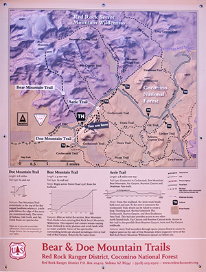
Click on Trail Map to Enlarge
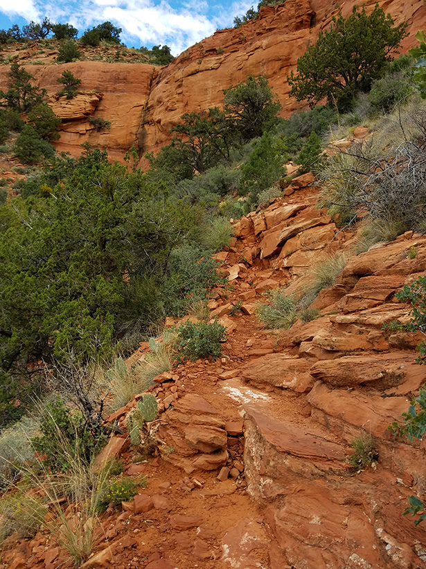
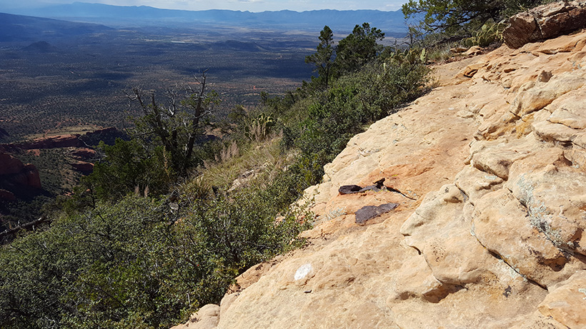
View Below The Last Two Rock Stairways
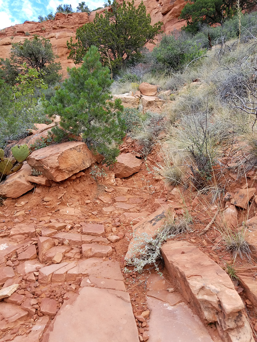
View Above The Last Two Rock Stairways
Bear Mountain Trail
This is a strenuous trail not suited for many hikers. It is in the desert
sun with no water along the trail. The difficulty that arises is
that there are so many of them and you must travel so high, that it
can easily wear down a hiker.
The hike is a five mile round
trip with a vertical climb of 2000 feet from the creek bed to the
true peak (as measured on USGS Topographic Maps). If you decide to take this
trail you need to leave early in the morning and plan for an all day
hike. Take lots and lots of water (1 gallon per hiker) and energy bars, along with
hiking boots, sunscreen and a wide brim hat. A hiking stick or
stabilization will also be of help.
One of the confusing factors that hikers
may encounter is that it appears the end
of the trail has moved. The
"True" peak on the old USFS map (red map
below) is actually north of the left
fork of Boynton Canyon. This is
confirmed on Typographic maps with an
elevation of over 6560 feet. However,
the new USGS map shows the trail end at
a peak below
the secondary peak which is at the west
side of the left fork of Boynton Canyon
(Blue USGS map to right).
Currently, there is a Trail End sign at
the trail peak (elevation over 6440
feet). The trail to the
true peak is too
poorly marked with many false trails to
go further than the peak where the trail
officially ends (as of 2016).
Download USGS Topgraphic Map with Peaks
Labeled
This website is not designed to provide directions or navigation of the
trails but solely intended to give you an idea what you may see and experience
on the hike.
The term strenuous,
refers to multiple long rock steps in the first part of the
trail followed by steep elevation of the trail as it
traverses up to the final trail peak. This is actually a
secondary peak, since the true peak is much further on an
ill-defined portion of the trail. It is also a little over
100 feet
higher in elevation.
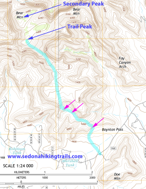
The
topographic map on the right shows the approximate location
of the Trail Peak and the Secondary Peak of Bear Mountain (Blue
Arrows). The true peak is even further.
1) First Section: HIking to the Rock
Plateu. The three purple arrows show the first, second and last
steep rock-stair sections of this secion of the
trail. (Click on map to enlarge)
2) Second Section: Hiking to the third
peak. This is mainly walking and easy stair
stepping rocks. This section ends at the top
of the Third Peak
3) Third Section: Hiking to the Trail
Peak (Fourth and Final Trail Peak)
The Bear Mountain Trail is well maintained up to the last
vertical staristep section and what we refer to as the Rock
Plateau. (Start of Second Section of the trail).
After
that, following the white arrows leading to the trail's peak
is very important (see picture on the left of a white trail
arrow near the top of the trail. However,
because of the slope of the rocks, these arrows can
be hard to see going down and there are many
side trails. Thus, inadvertently going off trail is easy to
do. It is advised that you take a compass or cell phone with
Google Maps. There is some cell coverage on the final two
sections of the trail and Google Maps and even Pokemon will
have the general area location of the trail. DO NOT PLAY
Pokemon on the trail. You need to watch your footing and not
paying attention can have a disastrous outcome. You need to
have good hiking shoes and take plenty of water.
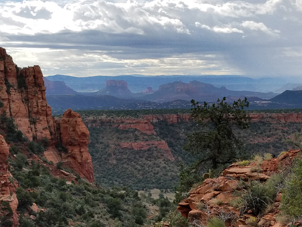
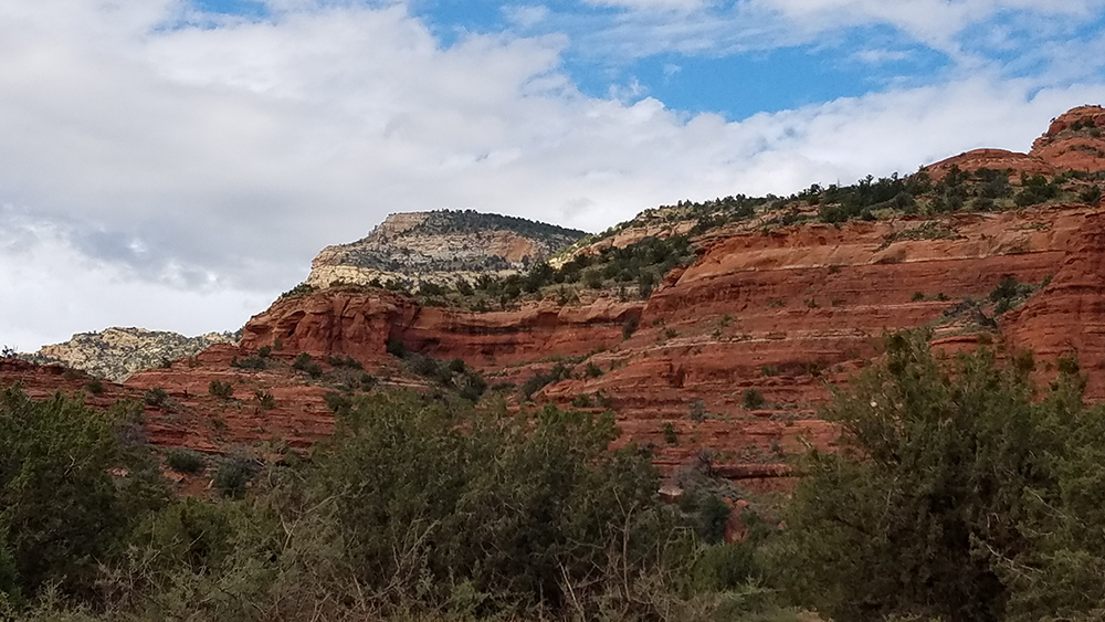
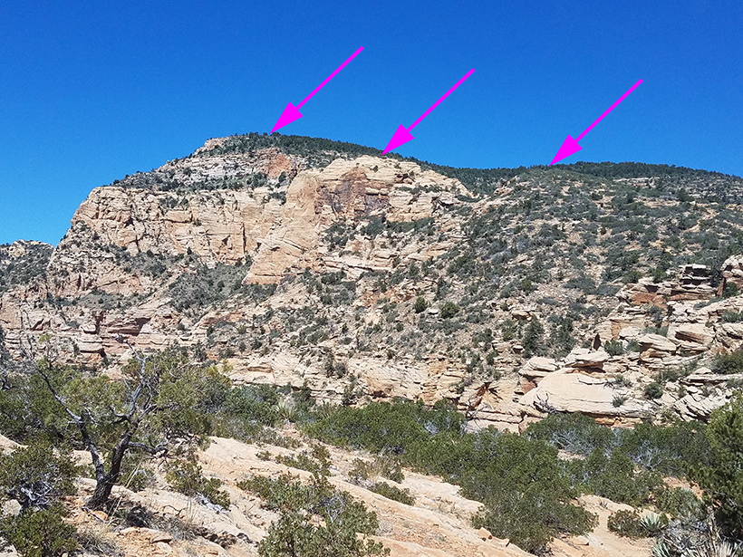
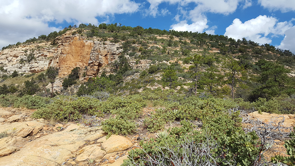
The
picture on the right shows the Trail Peak (On horizon at the
very top, next to red arrow) as viewed from the west base of
Bear Mountain. Note the portion of red rock (purple arrow), which helps to identify the
trail peak.
The Three Sections of Bear Mountain
Trail
The First Section:
The first is comprised of the approach to
the ascent section and three areas of steep rock
stairways. Traversing these step rocks is much
easier than climbing the trail to cathedral rock,
where one is on all fours. Ascent can be
accomplished with stepping up the many step rocks,
some of which appear to have been placed to aid the
hiker. Remember after this section, the hiker still
has a very long ways to go and in the Third Section,
the hiker will encounter sloping sections of the
trail which are near cliffs and the footing can
be precarious.
The First Section - First Leg:
Approach to the base of the
first stair climb. Below are pictures showing the
approach and the gentle rock steps leading up to the
first rock stairway. (The final approach to the
first rock stairway is shown on the right)
Climbing the first rock stairway. An easy
sloping trail leads to the first
rock stairway. The steps are easy to navigate without
the need to use arms or bending over.
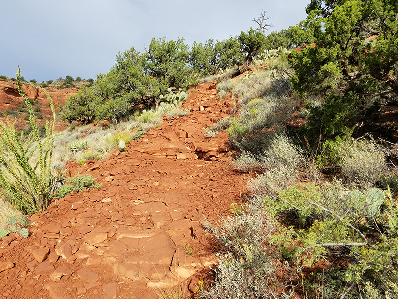
The First Section - Second Leg:
Traversing
the mid portion of the cliff face. This an easy hike
and just below a rock face you are at a level of the
top of the mesa of Doe Mountain. Excellent photo
opportunities and a good turning around point.
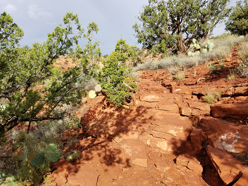
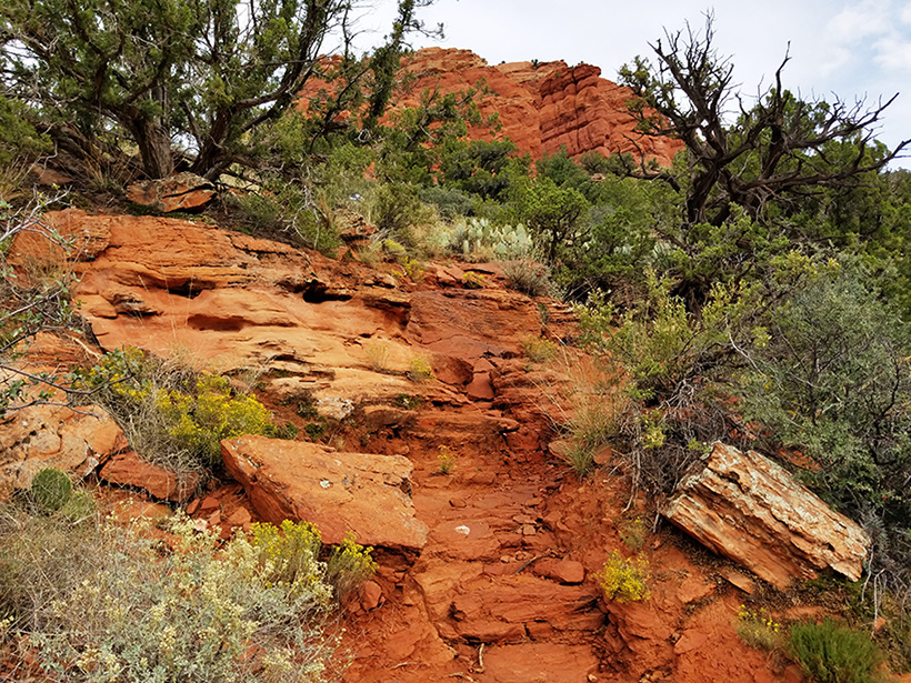
The First Section - Third Leg:
Traversing the final two
areas of rock
steps. This is a hard section of the trail due to its
length. Many rock steps to climb. There is a short area
of steps on the right side of the canyon, the trail
flattens,
leading to the left side of the canyon, where there is a
very long series of rock steps to climb inorder to reach the top
of the First Section . At the top is a rock plateau
which affords excellent views and is a good resting and
turning back point.
There
is a rock plateau at the top of the rock stairways
which has excellent views for photographing and is
an excellent turning back point. This is the end of the FIrst
Section and the starting point of the Second
Section.
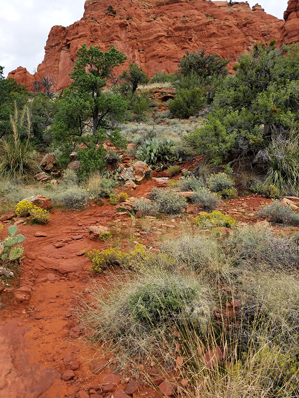
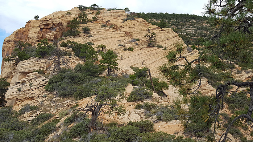
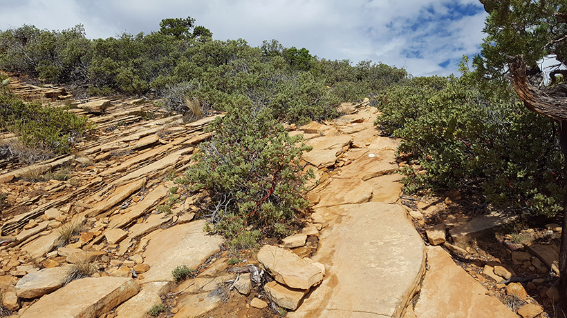
The
Second Section leads to the small Third Trail Peak
(see righ-hand arrow in the picture on right}.
The trail is semi-well marked. There are abundant rocks on the
trial along with a few rock steps. You will
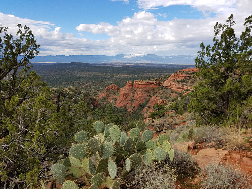
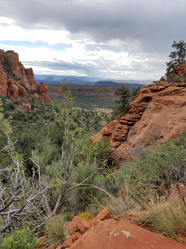
also pass along a wide ridge area. Fay Canyon will
be on your right. Hiking shoes with good treads are
definitely needed.
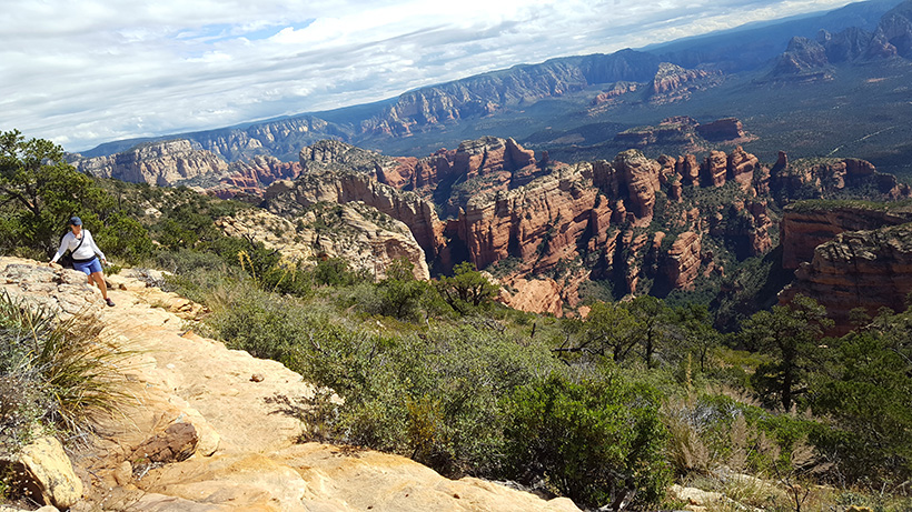
The picture on the right shows
the last three peaks of the trail. The Final
trail peak is denoted by the top left hand arrow. This
picture is taken from the valley between the first
and second trail peak.
The valley between the two is very wide. The
valley between the second and third peak is
approximately
100 yards.
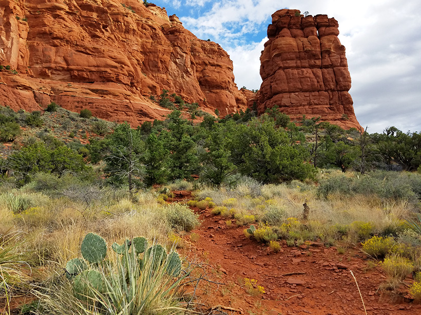
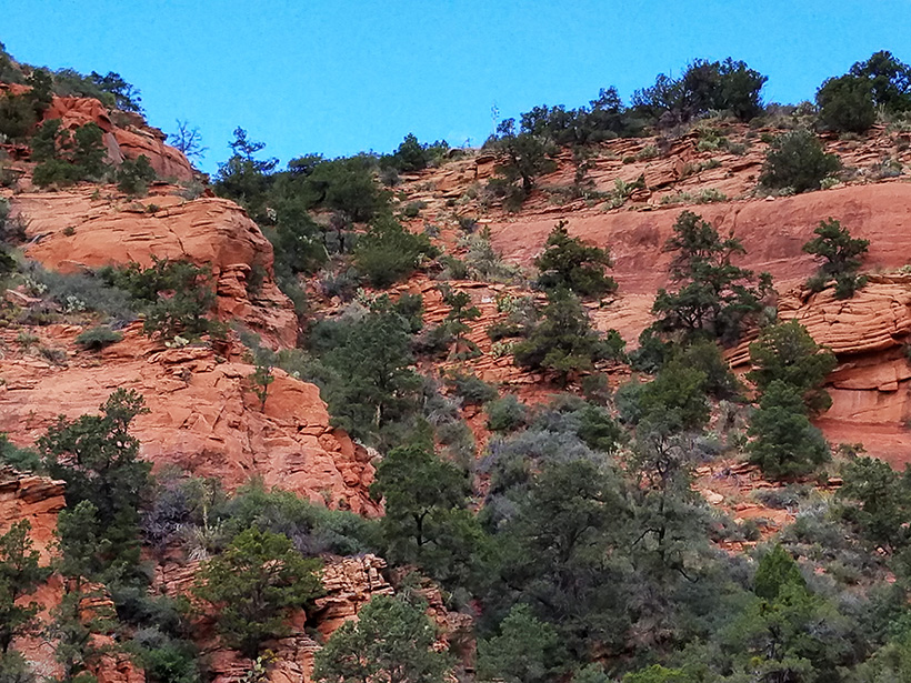
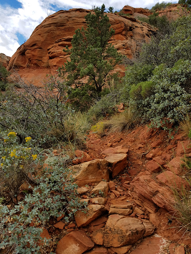
After
the third trail peak, the
trail steepens with sections of a sloping rock trail. The
picture on the right shows the fourth peak. A
narrow valley with a sloping trails leads to this
peak.
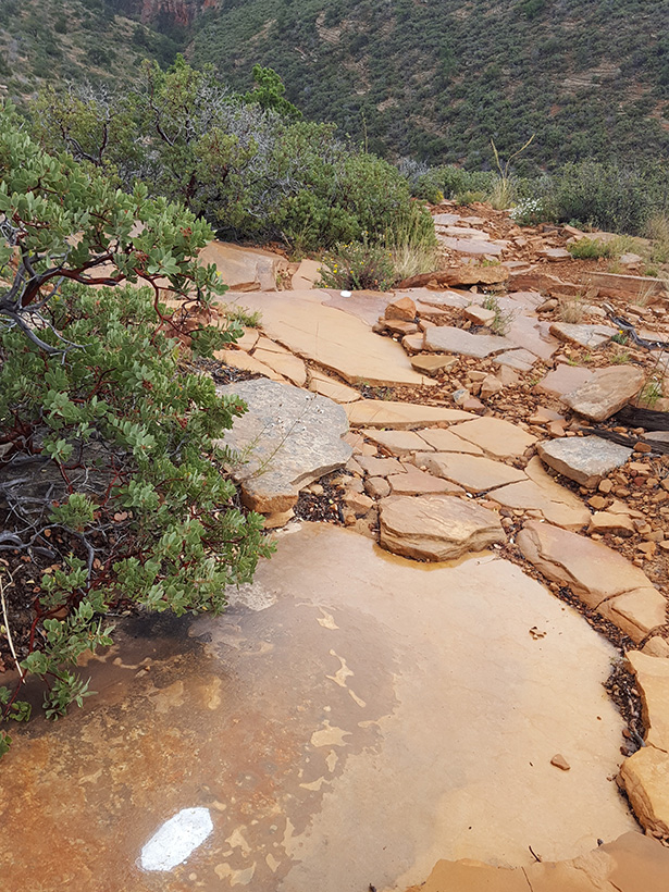
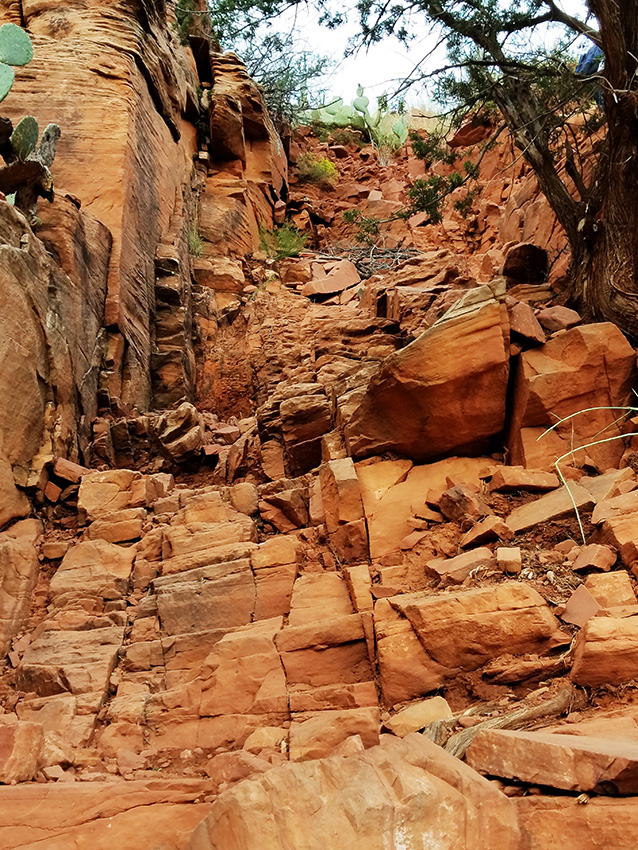
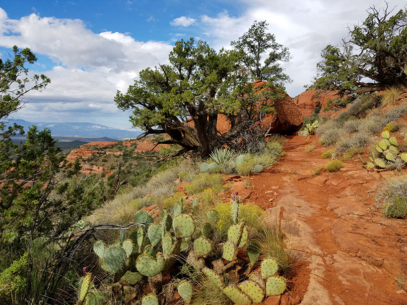
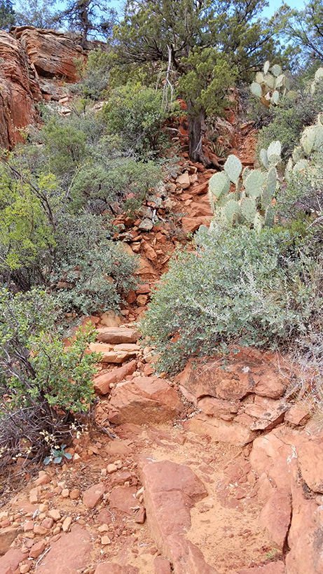
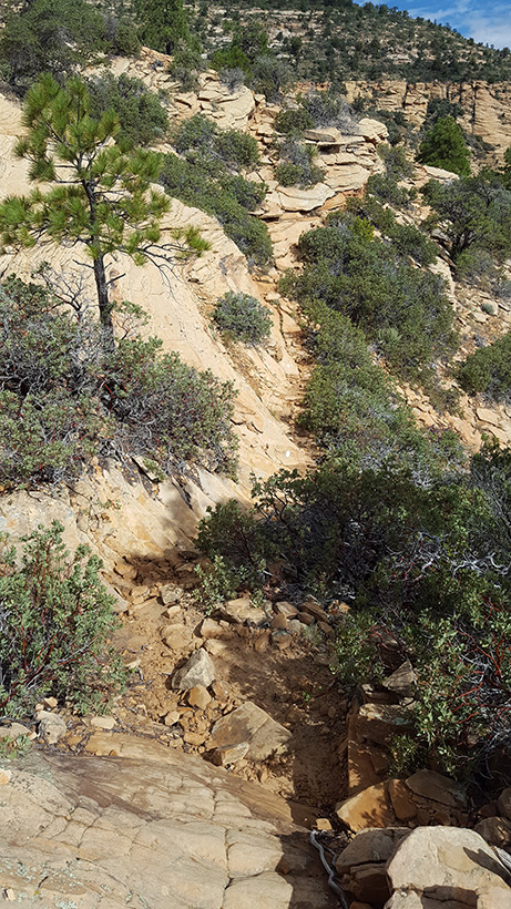
The pictures below show that sections of the trail
leading to the third peak that are
composed of smooth slanting rocks which would be treacherous
to traverse if wet.
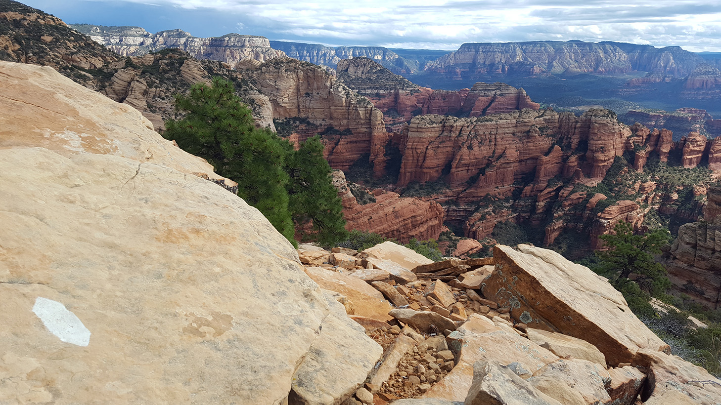
The final
leg of the trail leads to the
Final Trail Peak. The Trail Peak (end of trail) has a red section of rock
(picture to the right) and can be seen from the parking lot,
and from the west side of the mountain base.
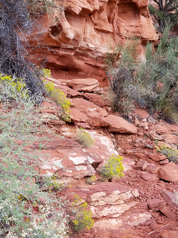
This section of
the trail has several areas of sloping rocks which need to
be traversed. There are cliffs on the downside of these
rocks. Hiking shoes with good treads are needed. These trail
sloping areas should not be traversed when the trail is
wet. Remember take your compass and a cell phone with google
maps (you may get
reception at the top). Because of the slope
of the rocks trail markers are
not as evident going down as going up. Click on Pictures to
Enlarge
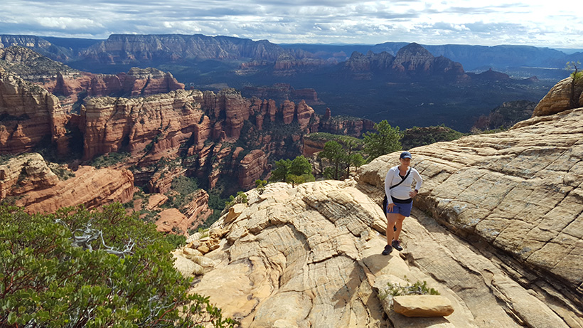
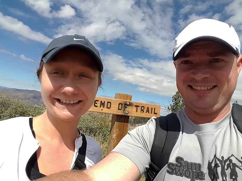
At the end of the trail you will encounter a sign. (There is
no "I-made-the-hike" sign-in-book at the top, which would be
nice.) The picture below shows a selfie of two hikers who
donated material to this website section.
The
trail ends at a peak (Trail Peak), the true peak is over
100 feet higher.
However, the path to it is ill-defined and it is
very easy to get lost
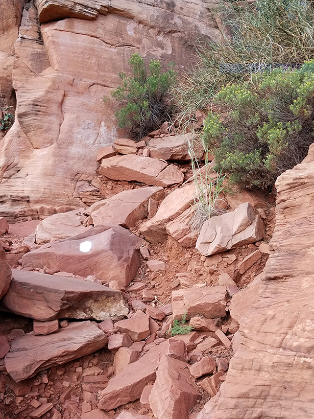
The first
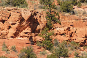
rock stariway is
shown on the right. It is about 30 feet in height and behind
the trees in the picture. The lower large trail picture below (bottom of the page) also shows this first
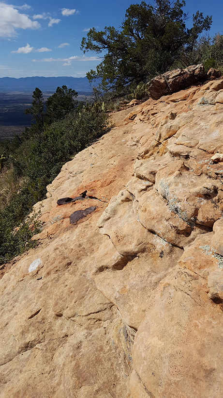
rock stairway (lower yellow arrow).
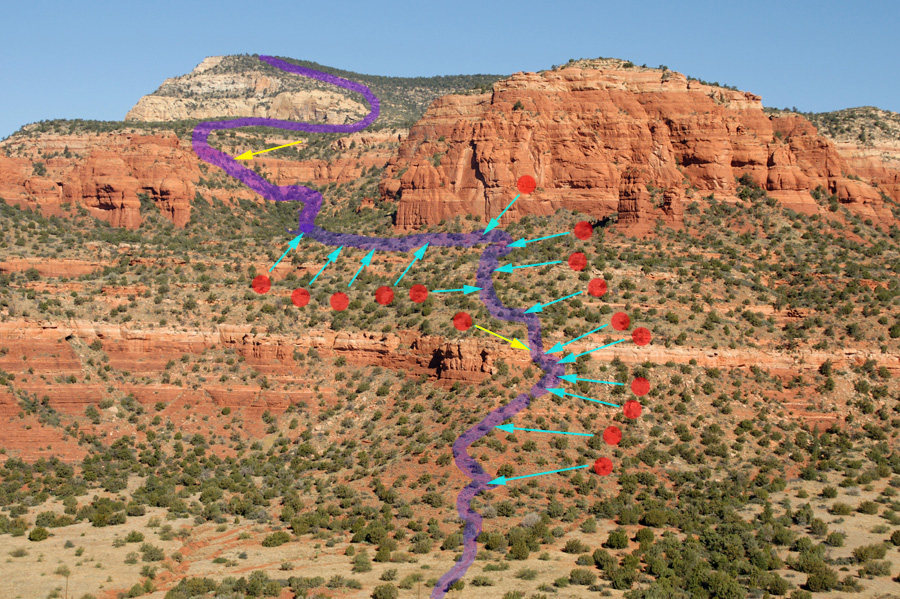
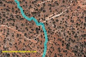
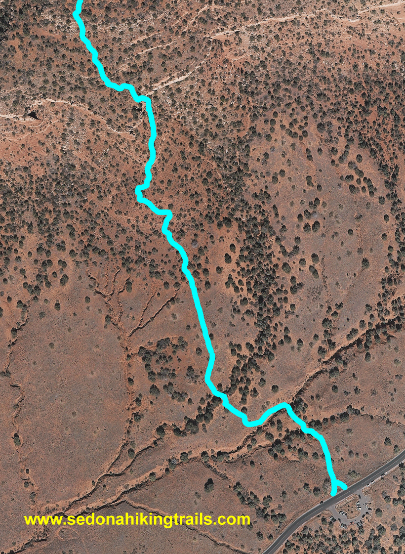
An
aerial view of the first rosck stairway is shown on the
right. The trail outlines will disappear every five seconds. Click on the picture to view an
expanded map of the lower one third of Bear
Mountain trail.
The trail gently climbs and then
turns to the left. The trail outline will disappear every 5 seconds.
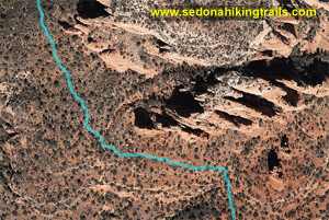
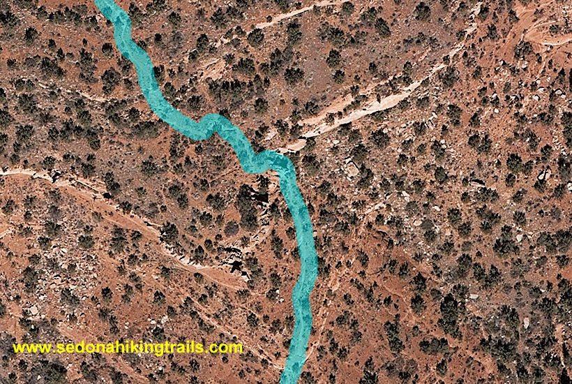
The aerial picture on the rights shows the second
steep
section of the trail. The top yellow arrow shows the
end of the last rock stairway and is at a rock plateau. The lower yellow arrow denotes the final rock stairway, about
60 yards in length. The
trail outline and arrows will disappear every 5 seconds.
Once you reach the top of the
rock stariways, you are not even half way to the trail's peak.
Aerial photographs of the remainder of
the trail can be seen and accessed from the left hand page
column. To view the complete trail on an aerial
photograph, click below:
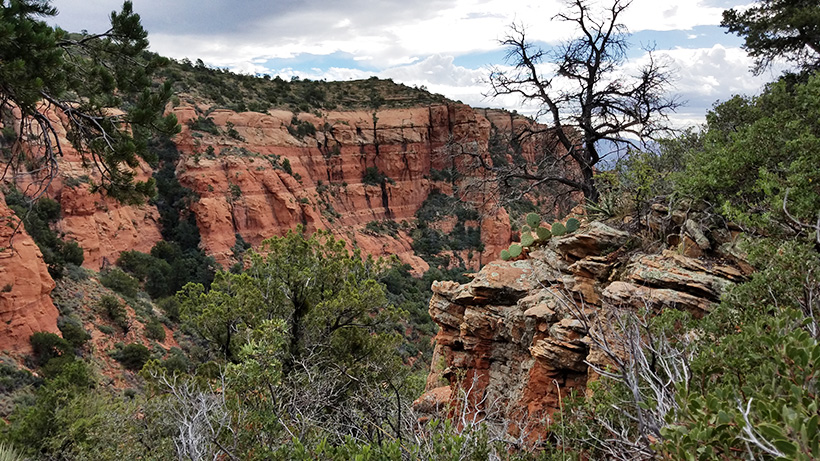
The large trail picture below was taken from Doe Mountain. The
step sections described above are designated with yellow arrows.
The peak seen in this picture is near the secondary peak (Not the true peak)
of Bear Mountain, wihch is currently the end of the trail.
On the Below Picture, Click on the "Red Circles" to enlarge the area
and see the hikers.


