|


|
|
|
Brins Mesa - Soldier Pass Loop - 4.5 Miles |
||
|
The route discribed in this section will start at the
Brins Mesa parking lot, hiking north to the top of Brins Mesa.
This website is not designed to provide directions or navigation of the trails but solely intended to give you an idea what you may see and experience on the hikes.
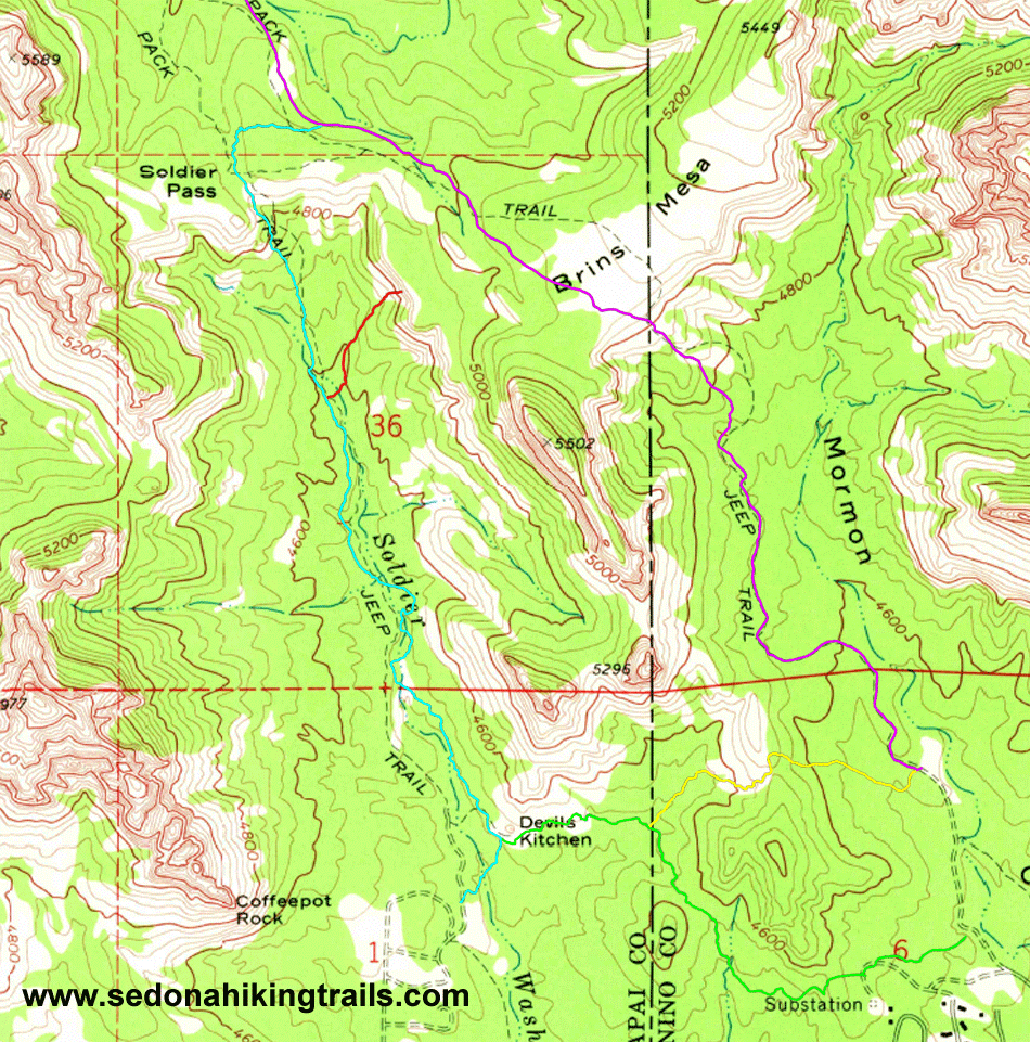
Some maps prior to 2009 have the Brins Mesa trailhead and parking lot next to Jordan trail's trailhead. A new and expanded parking area has been constructed north of the original parking lot and trailhead. The parking lot is now next to Cibola Pass Trailhead. Thus, on the return, take Cibola Trail as it branches North off of Jordan Trail. Cibola Trail is steeper but it will save about a half a mile and avoids hiking next to power lines. Below is a composite picture showing an aerial
photo with the trails outlined. The trail outlines will
disappear every 7 seconds. This is a two meg file and may take
some time to download. At the bottom of the page is a
topographic map of the trails. |

Copyright Kevin T Kavanagh, 2008 All Rights Reserved